

Listen to this Adventure
Photos by Michael Perez and Carlos Ulloa.
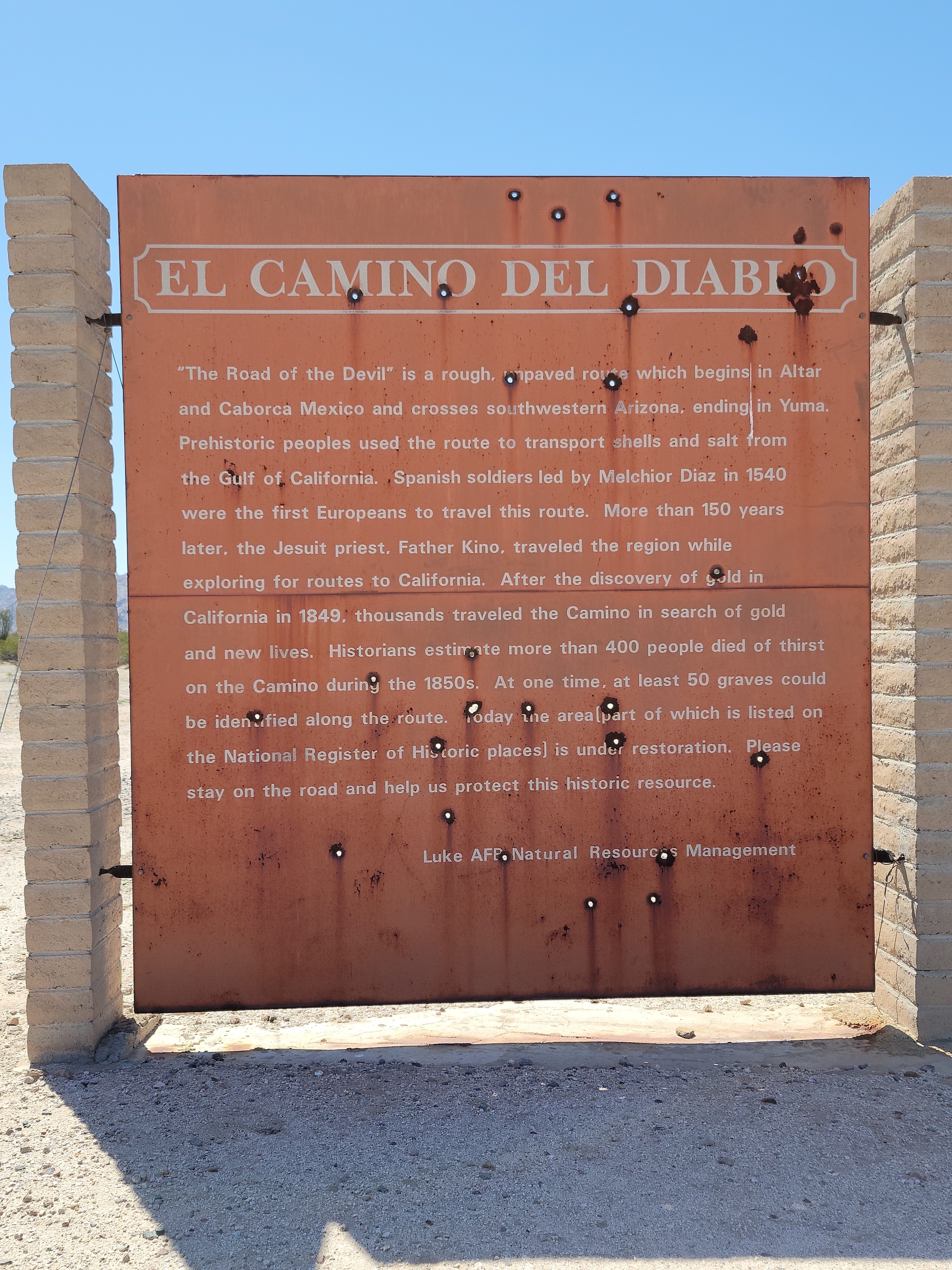
The Spanish Conquistadors, on their quest for land and gold, guided by natives used the CDD on their way to what is now California. The trail was used by the native peoples who lived in the desert where they hunted and knew where nature had hidden the water. Their valuable knowledge of the secret water sources helped the armor-clad soldiers and horses.

Rocky track through the ever-changing terrain.
As gold was found in California, the CDD became a major route for settlers, gold rushers, miners, and immigrants. The Devil likes death and the CDD does not forgive the weak. One can only imagine the countless people who died along the way and lay where they fell to become, over time, one with the desert.
As an Overlanding route, the CDD is one of the “must do” trips in North America. With that in mind, my friends and I planned a trip this February. In addition to the rough road and unpredictable weather, the CDD runs along the US/Mexico border and is ground zero for human and drug trafficking.
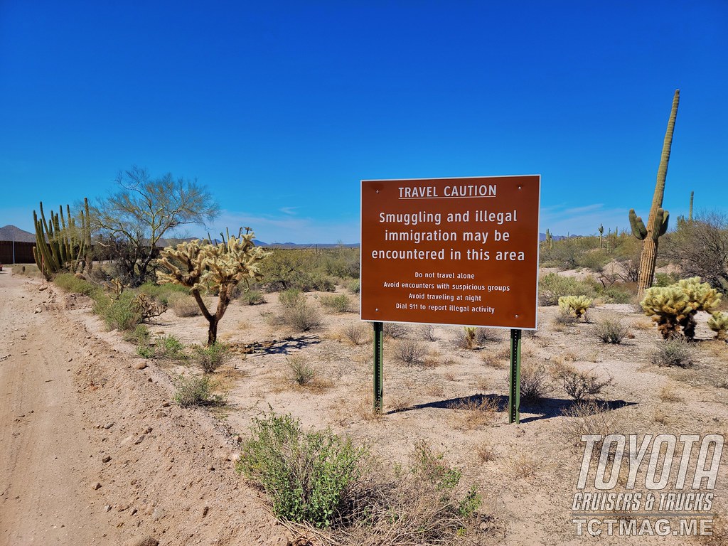
Sign warning of illegal smuggling.
The CDD runs from Ajo, AZ to Yuma, AZ and is about 157 miles long. While it can be driven in a couple of days it is best to take your time along the route and enjoy the desolate beauty. A permit is required for each vehicle and the process is quite easy. Watch the briefing video, read the rules and regulations, and obtain the permit:
https://www.fws.gov/refuge/Cabeza_Prieta/visit/rules_and_regulations.html

El Camino Del Diablo Map
Our small group of 4 consisted of Craig in his 2012 Jeep JK Wrangle Rubicon, Kirk in his 2013 Tacoma with AT Summit, Carlos in his 2019 ZR2 Colorado with Mission Overland trailer, and me in my 2013 200 Series Land Cruiser and Mission Overland trailer. When the day came to leave, we all were excited to get going. The plan was to drive about seven hours to Why, AZ and camp on BLM land. The next morning, we would start the adventure.
The drive on I-10 was uneventful other than some brutal winds, rainstorms, and even a period of heavy snow. Thankfully the wind died down before we got to Why and made our way to find a camp site.
The BLM land is typical open desert but was surprisingly somewhat crowded. We found a nice spot for our little convoy. We made dinner and soon were around the fire with cocktails in hand, talking about the things guys talk about while in the wilderness around a fire. Solving the problems of the world. The stars burst into the night sky and with the howling of coyotes we went to bed.
Instead of driving the usual route entering the CDD from State Hwy 89/Ajo Sonita Hwy, we were going to take the North Puerto Blanco Drive that starts in Organ Pipe Cactus National Monument. From there, we would drive North Puerto Blanco Drive to Quitobaquito and then take Pozo Nuevo Road north to the CDD. The last time I traveled the CDD, this road was not open. I was looking forward to driving this different route.
The morning was gorgeous as coffee was made and maps consulted. Even at 63 years of age I found myself excited at getting started on this trip. Even though, I have been on the CDD before, each time is different.
We drove to Why, topped off, and decided to have breakfast at the café next to the gas station. After a tasty breakfast, we officially started the adventure.
We got on AZ SR85 south and headed towards Organ Pipe Cactus National Monument. A last chance at using porcelain in the restroom, a chat with a Park Ranger and off we were.
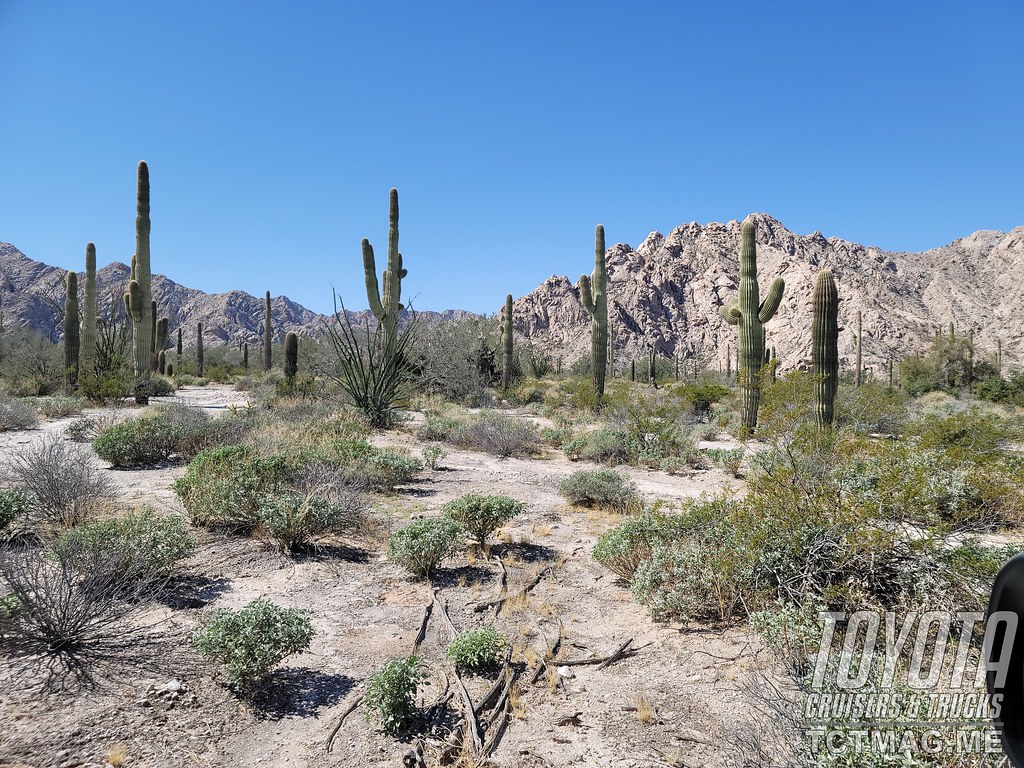
Saguaro Cactuses standing sentry over the desert.
The road started out paved but soon became gravel. We aired down and made our way through the desert. With the crunch of the tires on the road we chatted on the radio pointing out different sights. The desert has a beauty all its own. Majestic rock mountains and massive armies of saguaro cactus arms outstretched, spread across the landscape. Prominent were posted signs warning of illegal immigration and drug smuggling.
We soon came upon a campsite with pit-toilets and it was a perfect place to take a break. While we were hanging out a small group pulled into the area. Since we drive somewhat unique vehicles our pitstop turned into a show-and-tell session. We were not in a rush, so it was nice to visit and soon enough were on our way.
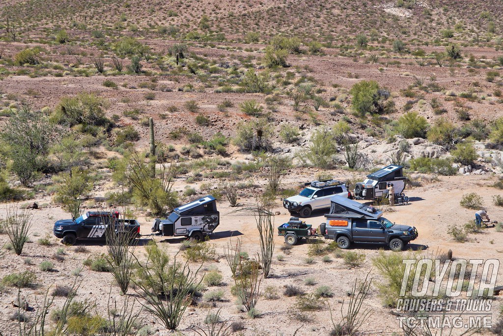
Our trucks and trailers.
We headed to Quitobaquito right on the border with Mexico. Quitobaquito Springs has been around for at least 16,000 years as evidenced by artifacts found in the area. This is the only water source for miles and has been an important resource for the natives as well as the Spanish Conquistadores and missionaries. The spring is also important for the wildlife of the area. There is a small parking lot and a trail to walk around the pond.
This section of the border is delineated by a wall. Just on the other side of the wall you can see what the border was like in the past: two strands of barbed wire. Mexico Highway Two runs alongside and the traffic speeding by seems strange contrasted with the desolate rugged desert on the U.S. side.
We headed north on Pozo Nuevo Road. This road is mostly a one track that alternates between sandy and rocky terrain. It was easy going until I looked in my right mirror and saw my trailer with a flat tire. Of course, it’s on a very narrow section of trail with very little room to work. I call out on the radio to let the guys know I’ll be delayed changing the tire. Craig, in his Jeep, was able to turn around. With his help, we changed the tire without too much delay.
Soon we were at Bates Ranch. It is hard to imagine anyone choosing to live in this desert. For over 40 years, the Grey family ran cattle. When Organ Pipe Cactus National Monument was established in 1937 the Greys were running cattle. He was granted an exemption from the National Park Service to run his cattle in the monument. Why? Because he was there first. Several original buildings remain as well as a windmill. Men and women were very hardy in those times.
It was time to head out to our first campsite on the CDD. The road was nicely graded, and we were motoring along when Carlos exclaimed on the radio “It ran in front of me!” We all stepped on each other asking what it was. Carlos told us and said a mountain lion ran right in front of his truck. The cat leaped right across the road. We stopped to look for tracks but saw nothing in the hard-rocky terrain.
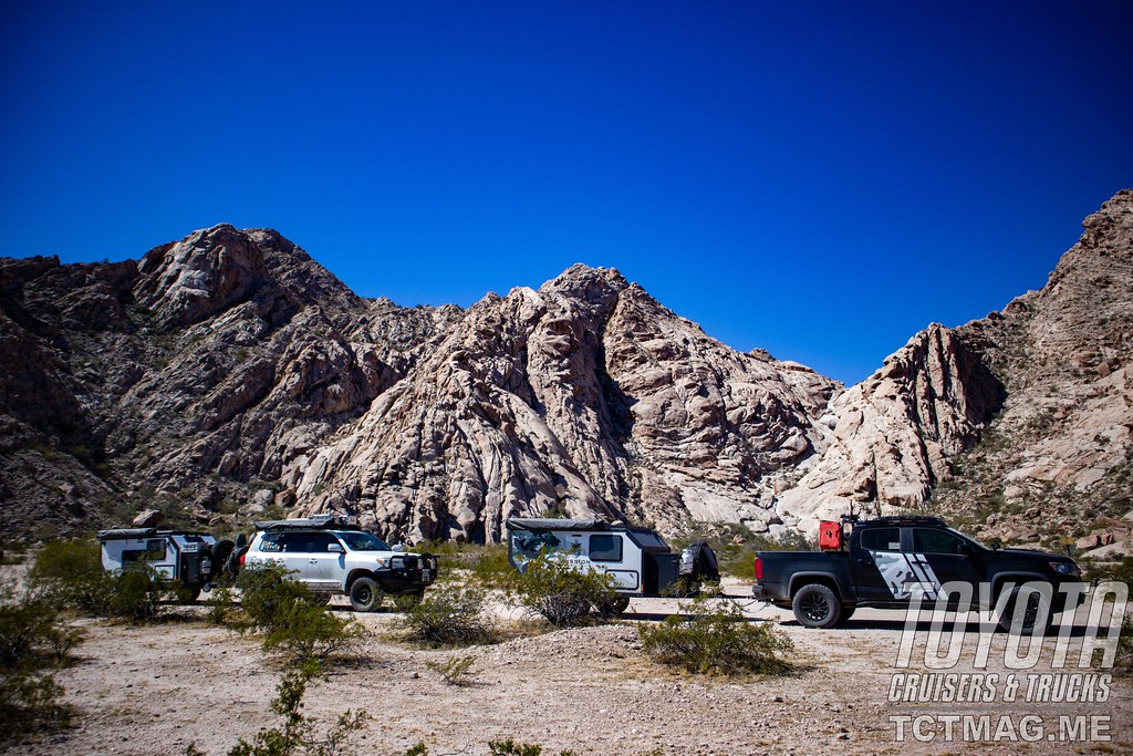
Camp at Christmas Tree Pass.
A couple of miles down the road there were stopped vehicles and some sort of law enforcement truck. We waited about 10 minutes until the truck headed toward us and stopped abreast of me. It was a Federal Wildlife Officer. We had a nice chat and I told him about the mountain lion. He had been patrolling the area for over 10 years and never saw a cat that close. He did say the desert really comes to life after dark. I showed him my permit, then told him, he had the best “office” to work in.
We moved on to Papago Well for our first camp site. Although one can camp almost anywhere it is always best to use established campsites to minimize the impact on the fragile desert. There was plenty of room for us, plus a picnic table and fire pit. After dinner, we sat around the fire and chatted about the day and some lessons learned about changing the flat tire. The major takeaway was needing two jacks. The first to jack up the trailer to remove the flat tire. The second to lift the trailer higher to get the spare on. If this happened again, I would use the high lift with a bottle jack as a backup to the high lift. Hopefully I won’t have to test out my theory. With a clear starry night, we turned in, and once again coyotes were howling at the moon.
During the night, I could hear Border Patrol vehicles roaring down the road as they kept the country safe. As George Orwell aptly said, “People sleep peaceably in their beds at night only because rough men stand ready to do violence on their behalf.”
The next morning was cool and Kirk cooked up some breakfast for us on his Skottle. After some bacon and eggs, we packed up and headed to our next camp. We had about 36 miles, but the road conditions change depending on the amount of traffic and whether there was any rain in the past. We were not in any rush, which is the best way to travel.
Along the route there are rescue towers. These towers have a button to push for help and the Border Patrol will respond. The signs on the towers are in English, Spanish and O’odham. O’odham is spoken by members of the Tohono O’odham Nation. There are also blue flags marking blue barrels with water. These are placed illegally by pro illegal immigration groups.
Soon we arrived at O’Neil’s grave. O’Neil was a miner who holds the distinction of being the only person known to have drowned in the desert. The legend is he got drunk and passed out in a mud hole. On the grave, were coins and little trinkets left as offerings. I found a face mask on the ground at the pull out for the grave. What kind of person would wear a mask outdoors in the desert and then throw it on the ground? I put it in my trash bag.
Next stop was Thule Wells campground with a rock memorial and a flagpole that was built by Boy Scouts. There is also a one-room building with a fireplace. Last year we tried to build a fire in the fireplace and were promptly smoked out because the chimney was blocked. This trip, we were going to camp along Christmas Tree Pass, about six miles to the north and off the main road.
As we were sitting around a picnic table, a couple of Border Patrol agents drove up in a modified UTV. We exchanged greetings and I asked how the security situation was in the area. One agent asked whether we were armed. We replied of course! He said good, always better to be safe out here. The agents told us there was heavy illegal activity to the west of us, but our location was protected by the wall and mountains.
The trail to Christmas Tree Pass was rough and there were a couple of tricky spots. Some off-camber combined with a curve made pulling a trailer a challenge. With some excellent spotting by Craig, we all got up to camp. It was a great spot. We were in a little amphitheater surrounded by rock walls on three sides.
Soon we had dinner cooking and a fire started. We sat around marveling at the unbelievable night sky and playing with a star gazing app. The coyotes started their howling and we retired to our beds.
The wind during the night was brutal. Even hitched to the Land Cruiser the trailer was rocking with each gust. I was pleased my trailer was nicely sealed and the canvas sides of the popup roof were not flapping.
The morning was still and clear. Other than our chairs having been blown around there was no evidence of the harsh winds. After coffee, we decide to drive to Tinajas Altas and to look for the water tanks. These tanks are depressions in the rock that collect water was used by the wildlife and people who crossed the desert. Once we got to the location as marked on the map, we quickly saw the green vegetation. The tinaja we walked to was rather large and had different animal tracks by it. Close by was a rock with depressions that the natives used for grinding seeds and other grains. It made me think of how man had adapted to live in just about any environment.
Our last camp was within view of the border. The weather had warmed up considerably. One of the advantages of my trailer was the onboard hot water heater and 37-gallon water tank. Time for showers.
After getting cleaned up, we looked for a couple of geocaches in the area and just plain relaxed. It was St Patrick’s Day and I was making corned beef and cabbage for dinner. As dinner was cooking, some F-16’s flew over at a low altitude and soon we had front row seats to the jets conducting some training. One the jets was painted in a camouflage design to resemble a Russian aircraft. It was an experience to have this private air show above us in the middle of nowhere.
The day went by quickly and soon it was time for some Irish libations and then some corned beef and cabbage. Dining on the CDD has certainly evolved since the days of the first pioneers whose diet was most likely some hardtack, beans, and bacon.
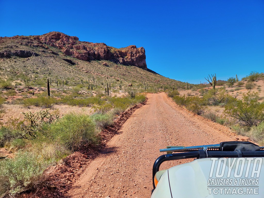
Wider track through the desert.
We enjoyed our last fire of the trip and talked abut the next trip we’d like to do. We had a long drive home to El Paso the next day and as with most trips it seemed to have gone by much too fast. The positive thing is we were already looking forward to our next adventure.
Trip notes:
In addition to having a printed copy of your permit take a picture of it so you have a backup copy when asked by the ranger.
Give the Border patrol the right of way and allow them to pass when possible.
It is important to have Mexico cellphone service when traveling along the CDD. A cellphone will register on the Mexican cell towers and not having that service will result in a very high cellphone bill. If you don’t have the international service, it is best to put your phone in airplane mode to avoid these expensive charges.
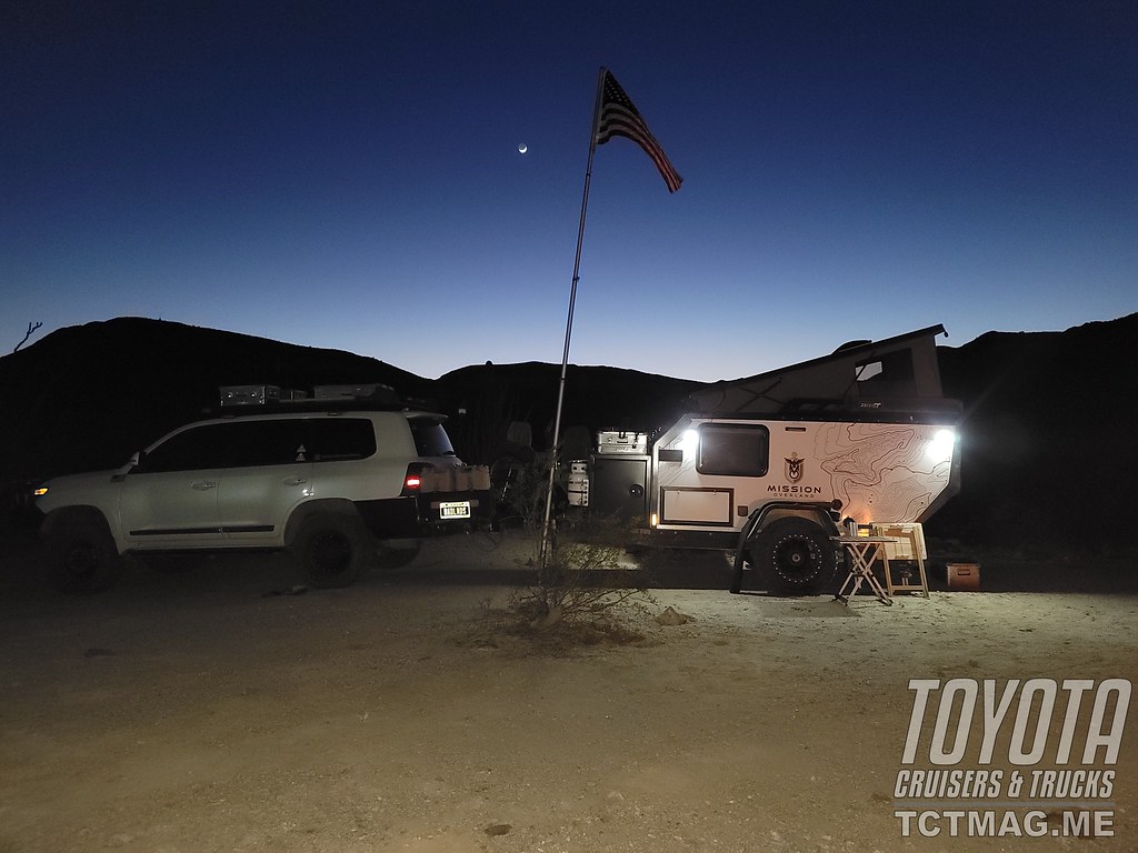
The authors Land Cruiser and Mission Overland trailer under the moon.
<Extra photos: 18 (Kirk, Craig, & Mike enjoying the shade), 20 (desert sunset), & 22 (beef & cabbage for St Pat’s day) >
Camino del Diablo Planning Notes
Enroute
Depending on your location, the Camino del Diablo (CDD) can be run East to West or vice versa. The starting and ending points, depending on your direction, are Ajo and Yuma, AZ. While Yuma is a good-sized city, Ajo is a small town with limited amenities so one should plan supplies accordingly. Upon completing the CDD, it is only a matter of jumping on either Interstate 10 or Interstate 8 to head home.
Trip Prep
As with any off-road trip, performing a map recon is essential in obtaining a 30,000-foot view of the trip. In performing this recon, you see that this trip traverses the Organ Pipe Cactus National Monument, Cabeza Prieta National Wildlife Refuge, and Barry M. Goldwater Air Force Range. You will need to plan and get permits.
If you are in a group of five or more, you will need a group permit. If you are towing trailers, the wildlife refuge will need pictures. It is always best to call ahead and find out exactly what they require for your specific trip. The number for the Cabeza National Wildlife Refuge is (520)-387-6483.
There are numerous online sources of information about the CDD you can access. (See resources section.)
Cellphone
The CDD is remote and there is virtually no cellular service. Proximity to the Mexican border results in cellphones registering on Mexican towers (TELCEL). If you do not have Mexican cell service on your cellular plan, you could incur hefty expenses operating on TELCEL. It would be best to either shut off your phone or put it on airplane mode until you reach either end.
Equipment
There are no services on the CDD. Bring recovery gear, spare tire, first aid kits, and everything you need off-road.
Border Patrol, federal wildlife officers and range wardens patrol the CDD, but their job is not to provide road service to the unprepared. They will call help for you, and that help will be costly.
Bring clothing for all types of weather. In the desert, the weather can change drastically in a matter in hours. Bring cold weather gear and rain gear.
Due to pervasive illegal immigration activity, travelers on the CDD should have a plan for such encounters. Border Patrol agents will ask if you are armed and every agent I’ve spoken to has always affirmed that decision.
Firearms/Security
Those possessing, transporting, or carrying firearms on national wildlife refuges must comply with all federal, state, and local laws.
Arizona is a Constitutional carry state. All citizens, 21 or over, who can legally own a firearm, can carry a handgun openly or concealed without a permit or license. This applies to both residents of the state and those just visiting. No target shooting allowed.
The CDD runs along the international border and there are numerous signs warning of smuggling and illegal immigration. The Mexican Drug Cartels control the south side of the border, and their activity is a reality. Personal security is something that should be discussed for your trip.
Weather
Weather in the desert is unpredictable. Always plan for both warm and cold weather. It also rains in the desert and when it rains there is the danger of the road flooding and flash floods in arroyos.
You can check weather conditions by checking the weather in Ajo and Yuma, AZ. That will give you a good idea of weather conditions on the east and west sides of the CDD area.
Travel in the summer is not recommended due to the triple digit temperatures. Late fall to late spring is the best times to travel.
Miscellaneous
There is no firewood along the CDD, so you are encouraged to bring your firewood. Please only use existing fire rings.
In addition to paper copies of your permits, a picture of the permits on your phone is a good idea if the paper copy disappears.
Do not completely trust a GPS. There are maps available of the CDD area that will offer a better understanding of the trails and surrounding areas.
Online Resources
https://www.nps.gov/orpi/index.htm
https://luke.isportsman.net/files/maps/CPNWR%202016%20Handout%20Map%20and%20Rules.pdf
https://www.fws.gov/refuge/cabeza_prieta/access_permit.html
http://npshistory.com/brochures/nwr/cabeza-prieta-1999.pdf
https://www.fws.gov/refuge/Cabeza_Prieta/visit/rules_and_regulations.html
https://www.mcasyuma.marines.mil/Staff-and-Agencies/Range-Natural-and-Cultural-Resources/
https://www.mcasyuma.marines.mil/Portals/152/Docs/Range/Instructions%20for%20BMGR.pdf
http://www.cohp.org/personal/images/Desert_Peaks_Thanksgiving_2014/documents/CPNWR_Visitor_Regulations.pdf
To get your copy of the
Fall 2021 Issue:


Follow us on Facebook, Twitter, and Instagram to get up-to-date industry news, events, and of course, amazing adventures, stories, and photos!